


221023

Vadim
User

Length
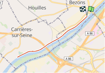
7.2 km

Max alt
36 m

Uphill gradient
83 m
Km-Effort
8.3 km

Min alt
16 m

Downhill gradient
83 m
Boucle
Yes
Creation date :
2023-10-22 09:39:34.0
Updated on :
2023-10-22 12:27:09.538
1h53
Difficulty : Medium

FREE GPS app for hiking
 SityTrail
IGN / Geographical institutes
SityTrail Plus
The world is yours!
About
Trail Walking of 7.2 km to be discovered at Ile-de-France, Val-d'Oise, Bezons. This trail is proposed by Vadim.
Description
xxx
Positioning
Country:
France
Region :
Ile-de-France
Department/Province :
Val-d'Oise
Municipality :
Bezons
Location:
Unknown
Start:(Dec)
Start:(UTM)
442586 ; 5418832 (31U) N.
Comments