


trigance cjub

clintest
User
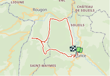

Length
16.6 km

Max alt
1156 m

Uphill gradient
727 m
Km-Effort
26 km

Min alt
640 m

Downhill gradient
715 m
Boucle
No
Creation date :
2023-10-22 06:52:53.412
Updated on :
2023-10-22 13:40:50.804
6h46
Difficulty : Very difficult

FREE GPS app for hiking
 SityTrail
IGN / Geographical institutes
SityTrail Plus
The world is yours!
About
Trail Walking of 16.6 km to be discovered at Provence-Alpes-Côte d'Azur, Var, Trigance. This trail is proposed by clintest.
Positioning
Country:
France
Region :
Provence-Alpes-Côte d'Azur
Department/Province :
Var
Municipality :
Trigance
Location:
Unknown
Start:(Dec)
Start:(UTM)
294102 ; 4848450 (32T) N.
Comments