


Trigance : Rancoumas-Carajuan

ETMU5496
User
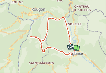

Length
16.4 km

Max alt
1156 m

Uphill gradient
720 m
Km-Effort
26 km

Min alt
640 m

Downhill gradient
705 m
Boucle
No
Creation date :
2023-10-22 06:56:17.0
Updated on :
2023-12-01 17:54:40.475
5h53
Difficulty : Medium

FREE GPS app for hiking
 SityTrail
IGN / Geographical institutes
SityTrail Plus
The world is yours!
About
Trail Walking of 16.4 km to be discovered at Provence-Alpes-Côte d'Azur, Var, Trigance. This trail is proposed by ETMU5496.
Description
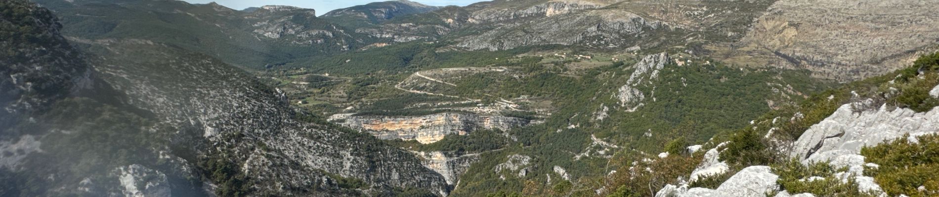
Depuis Trigance : Belvédère de Rancoumas et Clue de Carejuan par la colle de Breis
IBP = 72
Photos


Positioning
Country:
France
Region :
Provence-Alpes-Côte d'Azur
Department/Province :
Var
Municipality :
Trigance
Location:
Unknown
Start:(Dec)
Start:(UTM)
294101 ; 4848447 (32T) N.
Comments