


cauterets loimus 2023

LouisROGER
User GUIDE
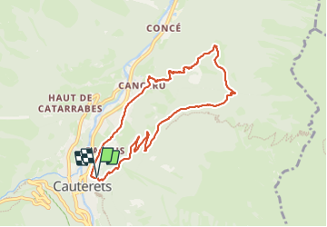

Length
9.1 km

Max alt
1398 m

Uphill gradient
557 m
Km-Effort
16.5 km

Min alt
881 m

Downhill gradient
563 m
Boucle
Yes
Creation date :
2023-10-27 07:44:28.846
Updated on :
2023-10-27 13:13:05.24
5h27
Difficulty : Difficult

FREE GPS app for hiking
 SityTrail
IGN / Geographical institutes
SityTrail Plus
The world is yours!
About
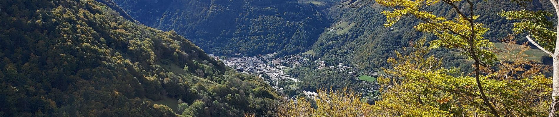
Trail Walking of 9.1 km to be discovered at Occitania, Hautespyrenees, Cauterets. This trail is proposed by LouisROGER.
Photos


Positioning
Country:
France
Region :
Occitania
Department/Province :
Hautespyrenees
Municipality :
Cauterets
Location:
Unknown
Start:(Dec)
Start:(UTM)
735852 ; 4752725 (30T) N.
Comments