


Cime des Colettes par col de Vial

GrouGary
User
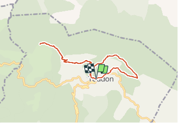

Length
9.5 km

Max alt
1498 m

Uphill gradient
673 m
Km-Effort
18.4 km

Min alt
980 m

Downhill gradient
675 m
Boucle
Yes
Creation date :
2023-10-27 07:28:46.342
Updated on :
2023-10-28 07:02:58.444
4h11
Difficulty : Medium

FREE GPS app for hiking
 SityTrail
IGN / Geographical institutes
SityTrail Plus
The world is yours!
About
Trail Walking of 9.5 km to be discovered at Provence-Alpes-Côte d'Azur, Maritime Alps, Toudon. This trail is proposed by GrouGary.
Description
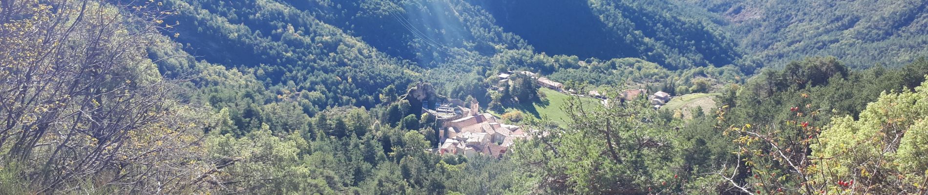
Petite boucle d'automne, sur sentier balisé et sans difficulté technique.
Vue à 360° sur l'Esteron sauvage et tourmenté, le Mercantour
Photos


Positioning
Country:
France
Region :
Provence-Alpes-Côte d'Azur
Department/Province :
Maritime Alps
Municipality :
Toudon
Location:
Unknown
Start:(Dec)
Start:(UTM)
348397 ; 4862632 (32T) N.
Comments