Trail Walking Thoraise - Le canyon de la Chandole - Photo

Le canyon de la Chandole

Marchez curieux

© OpenStreetMap contributors
Length
Length
9.4 km
Max alt
Max alt
381 m
Uphill gradient
Uphill gradient
235 m
Km-Effort
Km-Effort  
12.5 km
Min alt
Min alt
235 m
Downhill gradient
Downhill gradient
239 m
Boucle
Boucle
Yes
Creation date :
2023-10-28 16:00:17.0
Updated on :
2023-10-31 17:02:01.019

(2 Reviews)

Walking
Walking
2h50
Difficulty : Medium

Scan this QR Code to open this trail in the SityTrail application

FREE GPS app for hiking

Logo SityTrail SityTrail

IGN / Geographical institutes

Download SityTrail from the App Store Download SityTrail from Google Play

Logo SityTrail SityTrail World

The world is yours!

Download SityTrail from the App Store Download SityTrail from Google Play Download SityTrail on Huawei AppGallery

About

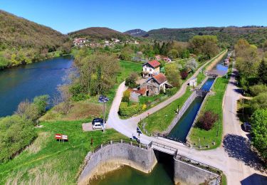
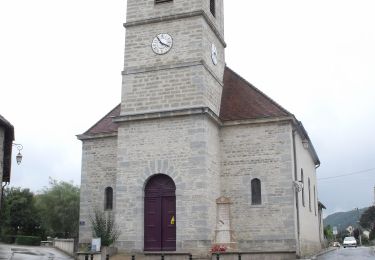
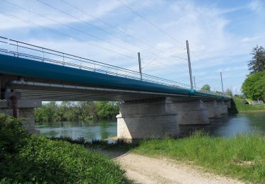
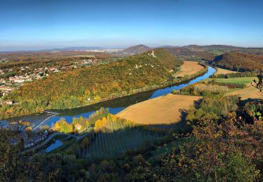
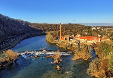
Trail Walking of 9.4 km to be discovered at Bourgogne-Franche-Comté, Doubs, Thoraise. This trail is proposed by RSVT Rando.

Description

Au départ de la décheterie de Boussière.

Elevation profile

Positioning

Country:
France
Region :
Bourgogne-Franche-Comté
Department/Province :
Doubs
Municipality :
Thoraise
Location:
Unknown
Start:(UTM)
720284 ; 5227631 (31T) N.

Comments

Please log in to post a review or rate the element


belle ranfo


Trails nearby

Trail On foot Busy - Sentier de la Pierre de Vorges - Photo
On foot
PRO

On foot

Easy
Busy, Bourgogne-Franche-Comté, Doubs, France
7.2 km | 9.4 km-effort
2h 8min
Yes
Trail On foot Vorges-les-Pins - Sentier des Crêtes - Photo
On foot
PRO

On foot

Easy
Vorges-les-Pins, Bourgogne-Franche-Comté, Doubs, France
4.2 km | 6.1 km-effort
1h 23min
Yes
Trail On foot Grandfontaine - Sentier de Béthanier-la-Marne - Photo
On foot
PRO

On foot

Easy
Grandfontaine, Bourgogne-Franche-Comté, Doubs, France
8.5 km | 10.2 km-effort
2h 18min
Yes
Trail On foot Boussières - Sentier du Ruisseau - Photo
On foot
PRO

On foot

Easy
Boussières, Bourgogne-Franche-Comté, Doubs, France
9.3 km | 12.5 km-effort
2h 49min
Yes
Trail On foot Osselle-Routelle - Sentier sur les Roches - Photo
On foot
PRO

On foot

Easy
Osselle-Routelle, Bourgogne-Franche-Comté, Doubs, France
7.6 km | 10.5 km-effort
2h 23min
Yes
Trail On foot Montferrand-le-Château - Sentier de Crête et Bois Rapin - Photo
On foot
PRO

On foot

Easy
Montferrand-le-Château, Bourgogne-Franche-Comté, Doubs, France
10.1 km | 14.1 km-effort
3h 11min
Yes
Trail On foot Thoraise - Sentier de Notre Dame du Mont - Photo
On foot
PRO

On foot

Easy
Thoraise, Bourgogne-Franche-Comté, Doubs, France
5.2 km | 7.7 km-effort
1h 44min
Yes
Trail Mountain bike Montferrand-le-Château - Avanne Avenney - Photo
Mountain bike
isabelle@porgye.com

Mountain bike

Montferrand-le-Château, Bourgogne-Franche-Comté, Doubs, France
14.2 km | 17 km-effort
1h 22min
No
Trail On foot Larnod - Sentier découverte de Larnod - Photo
On foot
PRO

On foot

Easy
Larnod, Bourgogne-Franche-Comté, Doubs, France
5.8 km | 7.2 km-effort
1h 37min
Yes


Close
My subscriptions