


Promenade chez swisstrails

swisstrails
User

Length
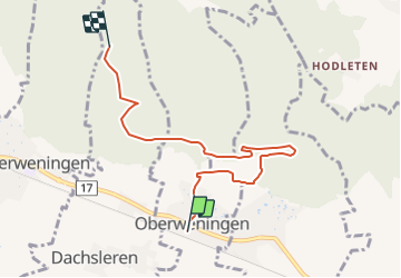
6 km

Max alt
662 m

Uphill gradient
271 m
Km-Effort
9.2 km

Min alt
464 m

Downhill gradient
137 m
Boucle
No
Creation date :
2014-12-10 00:00:00.0
Updated on :
2014-12-10 00:00:00.0
2h26
Difficulty : Unknown

FREE GPS app for hiking
 SityTrail
IGN / Geographical institutes
SityTrail Plus
The world is yours!
About
Trail Other activity of 6 km to be discovered at Zurich, Bezirk Dielsdorf, Oberweningen. This trail is proposed by swisstrails.
Photos


Positioning
Country:
Switzerland
Region :
Zurich
Department/Province :
Bezirk Dielsdorf
Municipality :
Oberweningen
Location:
Unknown
Start:(Dec)
Start:(UTM)
455187 ; 5260943 (32T) N.
Comments