


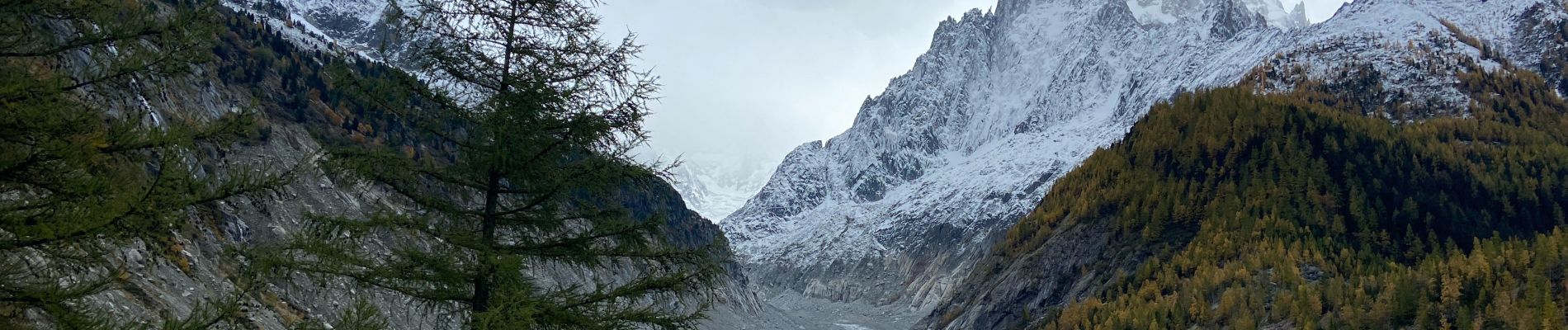
Point de vue Chapeau

michauxpaul
User
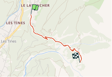

Length
2.3 km

Max alt
1587 m

Uphill gradient
337 m
Km-Effort
5.7 km

Min alt
1232 m

Downhill gradient
13 m
Boucle
No
Creation date :
2023-11-01 12:44:54.0
Updated on :
2023-11-01 14:17:54.823
1h31
Difficulty : Easy

FREE GPS app for hiking
 SityTrail
IGN / Geographical institutes
SityTrail Plus
The world is yours!
About
Trail Walking of 2.3 km to be discovered at Auvergne-Rhône-Alpes, Upper Savoy, Chamonix-Mont-Blanc. This trail is proposed by michauxpaul.
Description
Trek
Photos

Positioning
Country:
France
Region :
Auvergne-Rhône-Alpes
Department/Province :
Upper Savoy
Municipality :
Chamonix-Mont-Blanc
Location:
Unknown
Start:(Dec)
Start:(UTM)
337673 ; 5091175 (32T) N.
Comments