


2023-11-05_23h44m24_SF_INBOX_12975_3bb597_2023-10-08_16h25m07_montaigu

chasle
User
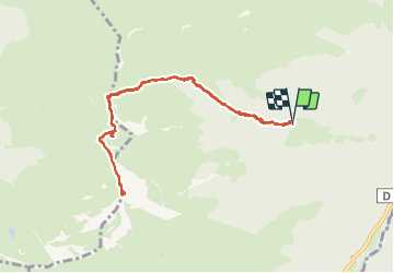

Length
10.2 km

Max alt
2321 m

Uphill gradient
1161 m
Km-Effort
26 km

Min alt
1147 m

Downhill gradient
1164 m
Boucle
Yes
Creation date :
2023-11-05 22:44:27.931
Updated on :
2023-11-12 17:43:05.899
5h49
Difficulty : Difficult

FREE GPS app for hiking
 SityTrail
IGN / Geographical institutes
SityTrail Plus
The world is yours!
About
Trail Walking of 10.2 km to be discovered at Occitania, Hautespyrenees, Bagnères-de-Bigorre. This trail is proposed by chasle.
Positioning
Country:
France
Region :
Occitania
Department/Province :
Hautespyrenees
Municipality :
Bagnères-de-Bigorre
Location:
Unknown
Start:(Dec)
Start:(UTM)
263194 ; 4763990 (31T) N.
Comments