


2)_Baou_Mourine_par_Arche_du__Saint-Vall

ETMU5496
User
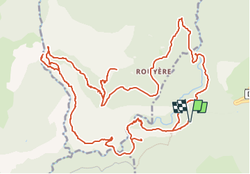

Length
19.3 km

Max alt
1128 m

Uphill gradient
1034 m
Km-Effort
33 km

Min alt
484 m

Downhill gradient
1034 m
Boucle
Yes
Creation date :
2023-11-07 15:52:44.0
Updated on :
2024-04-15 16:19:07.494
7h31
Difficulty : Difficult

FREE GPS app for hiking
 SityTrail
IGN / Geographical institutes
SityTrail Plus
The world is yours!
About
Trail Walking of 19.3 km to be discovered at Provence-Alpes-Côte d'Azur, Maritime Alps, Saint-Vallier-de-Thiey. This trail is proposed by ETMU5496.
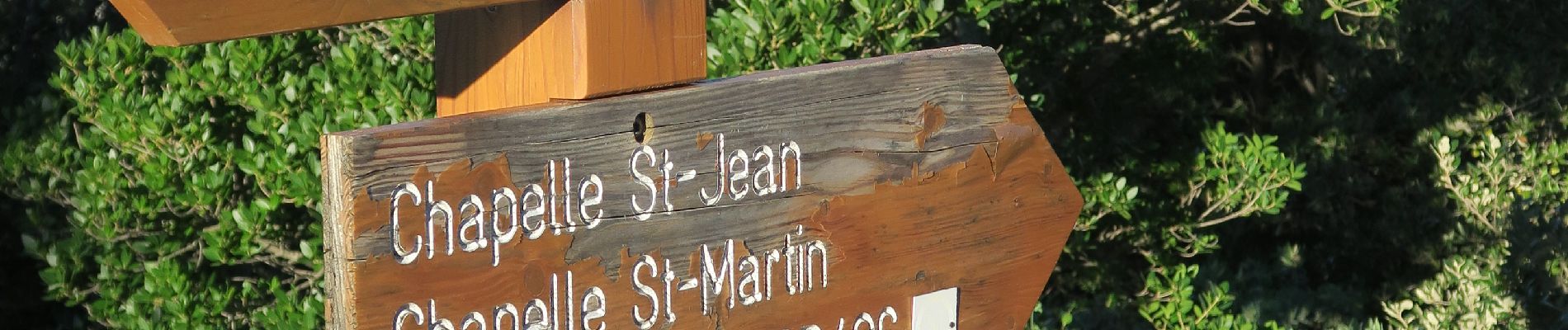
Photos
_Baou_Mourine_par_Arche_du__Saint-Vall - Photo 1")
_Baou_Mourine_par_Arche_du__Saint-Vall - Photo 2")
_Baou_Mourine_par_Arche_du__Saint-Vall - Photo 3")
_Baou_Mourine_par_Arche_du__Saint-Vall - Photo 4")
_Baou_Mourine_par_Arche_du__Saint-Vall - Photo 5")
_Baou_Mourine_par_Arche_du__Saint-Vall - Photo 6")
_Baou_Mourine_par_Arche_du__Saint-Vall - Photo 7")
_Baou_Mourine_par_Arche_du__Saint-Vall - Photo 8")
_Baou_Mourine_par_Arche_du__Saint-Vall - Photo 9")
_Baou_Mourine_par_Arche_du__Saint-Vall - Photo 10")
_Baou_Mourine_par_Arche_du__Saint-Vall - Photo 11")
_Baou_Mourine_par_Arche_du__Saint-Vall - Photo 12")
_Baou_Mourine_par_Arche_du__Saint-Vall - Photo 13")
_Baou_Mourine_par_Arche_du__Saint-Vall - Photo 14")
_Baou_Mourine_par_Arche_du__Saint-Vall - Photo 15")
_Baou_Mourine_par_Arche_du__Saint-Vall - Photo 16")
_Baou_Mourine_par_Arche_du__Saint-Vall - Photo 17")
_Baou_Mourine_par_Arche_du__Saint-Vall - Photo 18")
_Baou_Mourine_par_Arche_du__Saint-Vall - Photo 19")
_Baou_Mourine_par_Arche_du__Saint-Vall - Photo 20")
_Baou_Mourine_par_Arche_du__Saint-Vall - Photo 21")
_Baou_Mourine_par_Arche_du__Saint-Vall - Photo 22")
_Baou_Mourine_par_Arche_du__Saint-Vall - Photo 23")
_Baou_Mourine_par_Arche_du__Saint-Vall - Photo 24")
_Baou_Mourine_par_Arche_du__Saint-Vall - Photo 25")
_Baou_Mourine_par_Arche_du__Saint-Vall - Photo 26")
_Baou_Mourine_par_Arche_du__Saint-Vall - Photo 27")
_Baou_Mourine_par_Arche_du__Saint-Vall - Photo 28")
_Baou_Mourine_par_Arche_du__Saint-Vall - Photo 29")
29 photos in total. Please click on a photo to see them all in the gallery.
Positioning
Country:
France
Region :
Provence-Alpes-Côte d'Azur
Department/Province :
Maritime Alps
Municipality :
Saint-Vallier-de-Thiey
Location:
Unknown
Start:(Dec)
Start:(UTM)
323054 ; 4840877 (32T) N.
Comments