


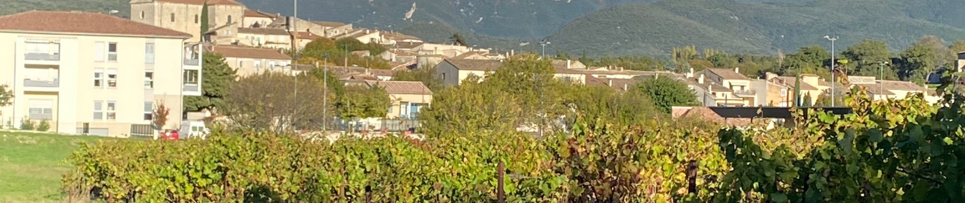
Taulignan le chemin de la soie

aitkhedache
User
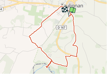

Length
5 km

Max alt
286 m

Uphill gradient
66 m
Km-Effort
5.8 km

Min alt
231 m

Downhill gradient
64 m
Boucle
Yes
Creation date :
2023-11-07 13:16:34.0
Updated on :
2023-11-08 09:21:24.72
20h03
Difficulty : Easy

FREE GPS app for hiking
 SityTrail
IGN / Geographical institutes
SityTrail Plus
The world is yours!
About
Trail Walking of 5 km to be discovered at Auvergne-Rhône-Alpes, Drôme, Taulignan. This trail is proposed by aitkhedache.
Description
Petite balade facile faisant le tour des anciens moulins et des usines Un petit crochet pour voir une belle cascade du Lez
Photos


Positioning
Country:
France
Region :
Auvergne-Rhône-Alpes
Department/Province :
Drôme
Municipality :
Taulignan
Location:
Unknown
Start:(Dec)
Start:(UTM)
657564 ; 4922794 (31T) N.
Comments