


111123

mzonzon05
User
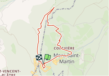

Length
4.2 km

Max alt
963 m

Uphill gradient
380 m
Km-Effort
9.3 km

Min alt
604 m

Downhill gradient
369 m
Boucle
Yes
Creation date :
2023-11-11 12:25:22.367
Updated on :
2023-11-11 14:20:00.057
1h54
Difficulty : Medium

FREE GPS app for hiking
 SityTrail
IGN / Geographical institutes
SityTrail Plus
The world is yours!
About
Trail Walking of 4.2 km to be discovered at Auvergne-Rhône-Alpes, Isère, Mont-Saint-Martin. This trail is proposed by mzonzon05.
Description
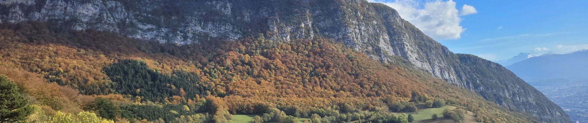
petite balade à faire en toutes saisons "sèches".
Jolis panoramas, cheminée sympatiqque et bien équipée.
on revient par Mont Saint Martin qui reste le calme et la quiétude.
Photos


Positioning
Country:
France
Region :
Auvergne-Rhône-Alpes
Department/Province :
Isère
Municipality :
Mont-Saint-Martin
Location:
Unknown
Start:(Dec)
Start:(UTM)
709265 ; 5016419 (31T) N.
Comments