


St Guilhem, Estagnol, roc Vigne, Arbousier

34christophe
User
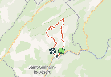

Length
11.9 km

Max alt
698 m

Uphill gradient
635 m
Km-Effort
20 km

Min alt
69 m

Downhill gradient
637 m
Boucle
Yes
Creation date :
2023-11-11 17:27:30.235
Updated on :
2023-11-11 17:28:35.455
4h37
Difficulty : Very difficult

FREE GPS app for hiking
 SityTrail
IGN / Geographical institutes
SityTrail Plus
The world is yours!
About
Trail Walking of 11.9 km to be discovered at Occitania, Hérault, Saint-Guilhem-le-Désert. This trail is proposed by 34christophe.
Positioning
Country:
France
Region :
Occitania
Department/Province :
Hérault
Municipality :
Saint-Guilhem-le-Désert
Location:
Unknown
Start:(Dec)
Start:(UTM)
545524 ; 4843552 (31T) N.
Comments