


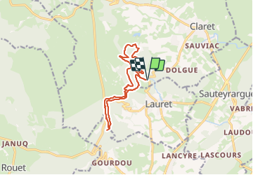
Lauret, Lafous, rocher du Causse

34christophe
User

Length
13.1 km

Max alt
400 m

Uphill gradient
395 m
Km-Effort
18.4 km

Min alt
186 m

Downhill gradient
395 m
Boucle
Yes
Creation date :
2023-11-12 21:20:22.584
Updated on :
2023-12-14 12:18:36.406
5h00
Difficulty : Medium

FREE GPS app for hiking
 SityTrail
IGN / Geographical institutes
SityTrail Plus
The world is yours!
About
Trail Walking of 13.1 km to be discovered at Occitania, Hérault, Claret. This trail is proposed by 34christophe.
Description
crêtes du Causse
Positioning
Country:
France
Region :
Occitania
Department/Province :
Hérault
Municipality :
Claret
Location:
Unknown
Start:(Dec)
Start:(UTM)
570678 ; 4854816 (31T) N.
Comments