Trail Walking Belvédère - Tête du Lac Autier - Photo
 bozo1970
bozo1970

User

© OpenStreetMap contributors
Length
Length
9.9 km
Max alt
Max alt
2716 m
Uphill gradient
Uphill gradient
1024 m
Km-Effort
Km-Effort  
24 km
Min alt
Min alt
1686 m
Downhill gradient
Downhill gradient
1023 m
Boucle
Boucle
Yes
Creation date :
2023-11-16 08:29:39.0
Updated on :
2023-11-16 20:22:02.613

(0 Reviews)

Walking
Walking
5h54
Difficulty : Very difficult

Scan this QR Code to open this trail in the SityTrail application

FREE GPS app for hiking

Logo SityTrail SityTrail

IGN / Geographical institutes

Download SityTrail from the App Store Download SityTrail from Google Play

Logo SityTrail SityTrail World

The world is yours!

Download SityTrail from the App Store Download SityTrail from Google Play Download SityTrail on Huawei AppGallery

About

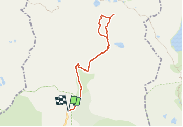
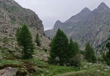
Trail Walking of 9.9 km to be discovered at Provence-Alpes-Côte d'Azur, Maritime Alps, Belvédère. This trail is proposed by bozo1970.

Description

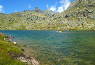
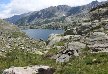
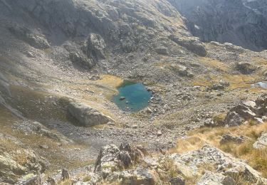
Montée par le Lac Autier
Bifurcation vers la Tête
Montée par le versant sud et le Pas du Niré
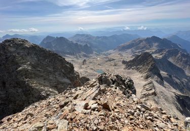
Sommet en 2h55’ 5km et D  1274 m
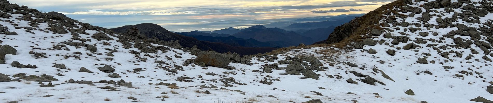
Magnifique vue à 360 sur les 25 sommets principaux du coin, hallucinant !!!   les lacs et le refuge de Nice
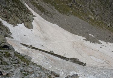
Descente par le versant Ouest en longeant la crête puis en plongeant à droite jusqu’au Col
Cramponnage sur 200m car plaques de glace
Descente plein sud et récupération du tracé de montée
Chamois    
Bouquetin
A/R en 5h54’

Elevation profile

Photos

Positioning

Country:
France
Region :
Provence-Alpes-Côte d'Azur
Department/Province :
Maritime Alps
Municipality :
Belvédère
Location:
Unknown
Start:(UTM)
371891 ; 4881302 (32T) N.

Trails nearby

Trail On foot Tende - Tour du Grand Capelet - Etape 3 - Photo
On foot
PRO

On foot

Easy
Tende, Provence-Alpes-Côte d'Azur, Maritime Alps, France
6.4 km | 12.9 km-effort
2h 56min
No
Trail On foot Belvédère - Les Merveilles par la Gordolasque - Photo
On foot
PRO

On foot

Medium
Belvédère, Provence-Alpes-Côte d'Azur, Maritime Alps, France
13 km | 29 km-effort
6h 35min
Yes
Trail On foot Saint-Martin-Vésubie - Circuit de Fenestre - Photo
On foot
PRO

On foot

Easy
Saint-Martin-Vésubie, Provence-Alpes-Côte d'Azur, Maritime Alps, France
8.1 km | 16.4 km-effort
3h 44min
Yes
Trail Walking Saint-Martin-Vésubie - Lacs de Prals - Photo
Walking
michlie

Walking

Easy
(1)
Saint-Martin-Vésubie, Provence-Alpes-Côte d'Azur, Maritime Alps, France
6.7 km | 13.5 km-effort
2h 48min
Yes
Trail Walking Tende - Valmasque- Bego-Pas de L'Autier-Countet - Photo
Walking
ch2slv

Walking

Difficult
(1)
Tende, Provence-Alpes-Côte d'Azur, Maritime Alps, France
16.9 km | 30 km-effort
5h 57min
No
Trail Other activity Saint-Martin-Vésubie - gr 52 merveilles - Photo
Other activity
legris

Other activity

Very easy
(1)
Saint-Martin-Vésubie, Provence-Alpes-Côte d'Azur, Maritime Alps, France
27 km | 53 km-effort
Unknown
No
Trail Walking Saint-Martin-Vésubie - Le Gélas - Photo
Walking
bozo1970

Walking

Very difficult
Saint-Martin-Vésubie, Provence-Alpes-Côte d'Azur, Maritime Alps, France
11.4 km | 27 km-effort
7h 33min
No
Trail Walking Saint-Martin-Vésubie - Lacs Balaour - Photo
Walking
bozo1970

Walking

Easy
Saint-Martin-Vésubie, Provence-Alpes-Côte d'Azur, Maritime Alps, France
7.6 km | 16.1 km-effort
2h 57min
Yes
Trail Walking Belvédère - randonnée du Mercantour le 09 juin 2023 - Photo
Walking
Loli27

Walking

Medium
Belvédère, Provence-Alpes-Côte d'Azur, Maritime Alps, France
4.1 km | 6.5 km-effort
1h 58min
Yes


Close
My subscriptions