


Le circuit du Pont Moutonnier

ARVIEU
User
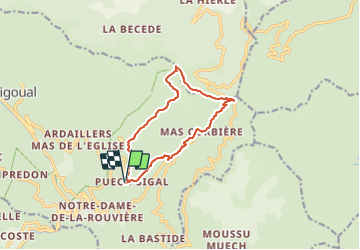

Length
11.7 km

Max alt
1005 m

Uphill gradient
592 m
Km-Effort
19.6 km

Min alt
453 m

Downhill gradient
591 m
Boucle
Yes
Creation date :
2023-11-17 17:02:42.742
Updated on :
2023-11-17 17:07:24.609
6h00
Difficulty : Medium

FREE GPS app for hiking
 SityTrail
IGN / Geographical institutes
SityTrail Plus
The world is yours!
About
Trail Walking of 11.7 km to be discovered at Occitania, Gard, Val-d'Aigoual. This trail is proposed by ARVIEU.
Description
Prévoir de partir de la Rouvière
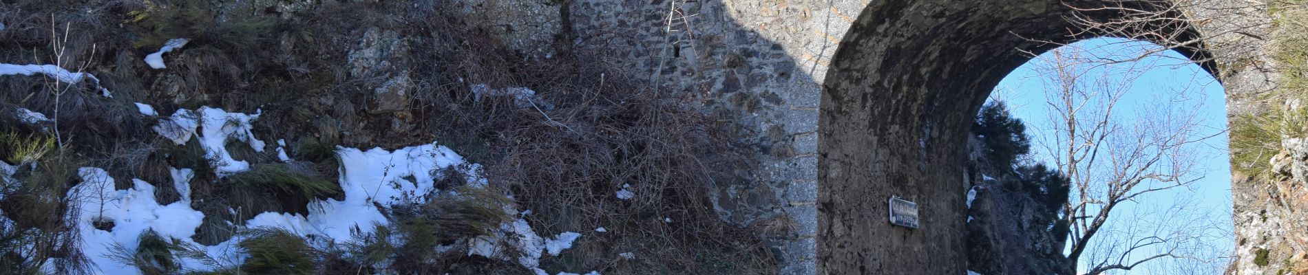
Photos


Positioning
Country:
France
Region :
Occitania
Department/Province :
Gard
Municipality :
Val-d'Aigoual
Location:
Notre-Dame-de-la-Rouvière
Start:(Dec)
Start:(UTM)
556813 ; 4878429 (31T) N.
Comments