


valdrome

oliviergau
User
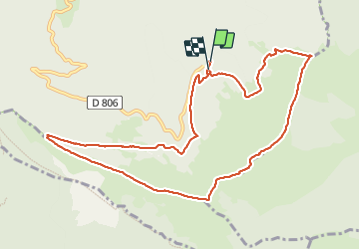

Length
11.4 km

Max alt
1742 m

Uphill gradient
602 m
Km-Effort
19.4 km

Min alt
1304 m

Downhill gradient
607 m
Boucle
Yes
Creation date :
2023-11-18 09:28:38.371
Updated on :
2023-11-18 18:01:44.356
4h36
Difficulty : Medium

FREE GPS app for hiking
 SityTrail
IGN / Geographical institutes
SityTrail Plus
The world is yours!
About
Trail Walking of 11.4 km to be discovered at Auvergne-Rhône-Alpes, Drôme, Valdrôme. This trail is proposed by oliviergau.
Positioning
Country:
France
Region :
Auvergne-Rhône-Alpes
Department/Province :
Drôme
Municipality :
Valdrôme
Location:
Unknown
Start:(Dec)
Start:(UTM)
707132 ; 4928758 (31T) N.
Comments