Trail Walking Grospierres - sampzon - Photo
© OpenStreetMap contributors
Length
Length
14.7 km
Max alt
Max alt
362 m
Uphill gradient
Uphill gradient
339 m
Km-Effort
Km-Effort  
19.2 km
Min alt
Min alt
93 m
Downhill gradient
Downhill gradient
334 m
Boucle
Boucle
No
Creation date :
2023-11-19 08:50:46.64
Updated on :
2023-11-19 11:19:04.397

(0 Reviews)

Walking
Walking
2h27
Difficulty : Very difficult

Scan this QR Code to open this trail in the SityTrail application

FREE GPS app for hiking

Logo SityTrail SityTrail

IGN / Geographical institutes

Download SityTrail from the App Store Download SityTrail from Google Play

Logo SityTrail SityTrail World

The world is yours!

Download SityTrail from the App Store Download SityTrail from Google Play Download SityTrail on Huawei AppGallery

About

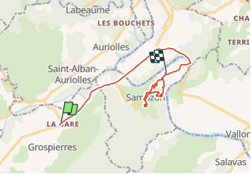
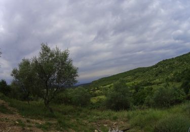
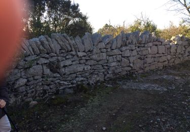
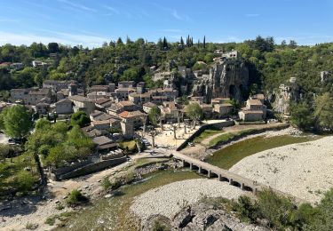
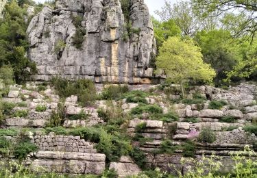
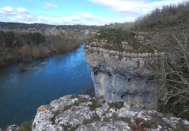
Trail Walking of 14.7 km to be discovered at Auvergne-Rhône-Alpes, Ardèche, Grospierres. This trail is proposed by Gisele Denaes.

Description

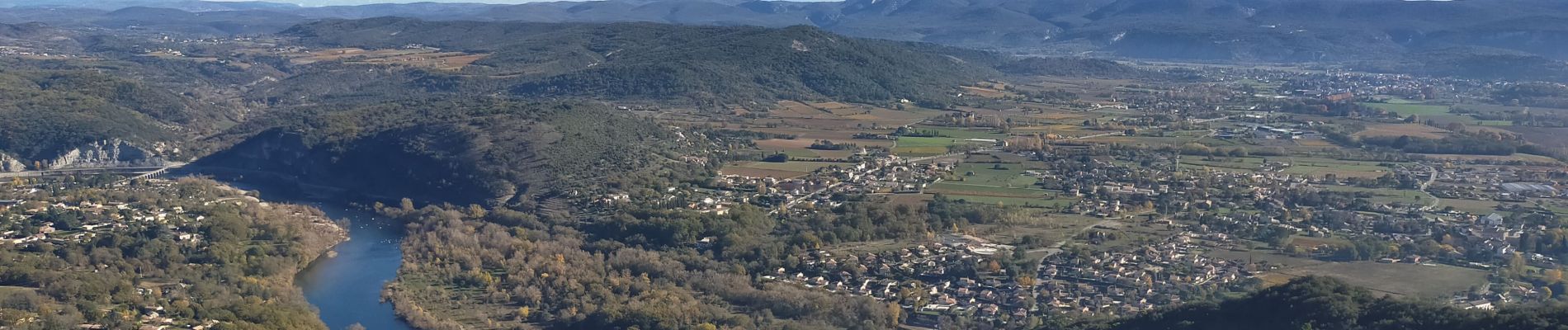
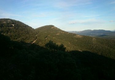
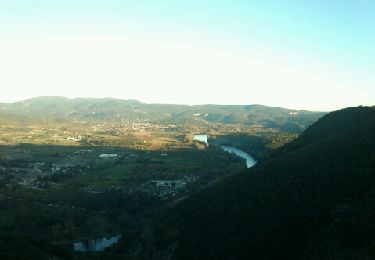
dernière partie pour monter au rocher difficile.

Elevation profile

Photos

Positioning

Country:
France
Region :
Auvergne-Rhône-Alpes
Department/Province :
Ardèche
Municipality :
Grospierres
Location:
Unknown
Start:(UTM)
603012 ; 4918051 (31T) N.

Trails nearby

Trail Walking Grospierres - Grospierres - col de la Cize - Photo
Walking
pb07

Walking

Medium
(1)
Grospierres, Auvergne-Rhône-Alpes, Ardèche, France
12.2 km | 17.5 km-effort
3h 35min
Yes
Trail Nordic walking Grospierres - YG Grospierres - Photo
Nordic walking
yago1404

Nordic walking

Medium
(1)
Grospierres, Auvergne-Rhône-Alpes, Ardèche, France
13.4 km | 20 km-effort
3h 0min
Yes
Trail Walking Sampzon - Sampzon - Pas des pigeons - Photo
Walking
pb07

Walking

Easy
(3)
Sampzon, Auvergne-Rhône-Alpes, Ardèche, France
11.6 km | 17.1 km-effort
3h 11min
Yes
Trail Mountain bike Vallon-Pont-d'Arc - Vallon_Pont_d'Arc_20210712_092148 - Photo
Mountain bike
GUIDE
pascalou73

Mountain bike

Very easy
Vallon-Pont-d'Arc, Auvergne-Rhône-Alpes, Ardèche, France
27 km | 34 km-effort
Unknown
Yes
Trail Walking Saint-Alban-Auriolles - St Alban la falaise - Photo
Walking
marquet

Walking

Easy
(1)
Saint-Alban-Auriolles, Auvergne-Rhône-Alpes, Ardèche, France
9.5 km | 12.1 km-effort
3h 2min
Yes
Trail sport Ruoms - Ruoms, Labeaume - Photo
sport
alinetpierre

sport

Very easy
Ruoms, Auvergne-Rhône-Alpes, Ardèche, France
17.5 km | 23 km-effort
Unknown
Yes
Trail Walking Labeaume - 07_labeaume-peroche_8km230m - Photo
Walking
SyMA

Walking

Easy
Labeaume, Auvergne-Rhône-Alpes, Ardèche, France
8 km | 11.1 km-effort
2h 52min
Yes
Trail Walking Chandolas - 3 - Maisoneuve Ron Redon Chandolas 8041m - Photo
Walking
ganinette

Walking

Medium
Chandolas, Auvergne-Rhône-Alpes, Ardèche, France
8 km | 9.4 km-effort
2h 7min
Yes
Trail Walking Saint-Alban-Auriolles - Font Méjane - Photo
Walking
dadodeca

Walking

Easy
Saint-Alban-Auriolles, Auvergne-Rhône-Alpes, Ardèche, France
7.5 km | 9.1 km-effort
1h 57min
Yes


Close
My subscriptions