


Auriasque - Bouverie

GeorgesV.
User
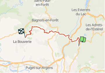

Length
20 km

Max alt
418 m

Uphill gradient
666 m
Km-Effort
30 km

Min alt
38 m

Downhill gradient
769 m
Boucle
No
Creation date :
2023-11-19 07:37:12.0
Updated on :
2023-11-20 16:35:11.693

FREE GPS app for hiking
 SityTrail
IGN / Geographical institutes
SityTrail Plus
The world is yours!
About
Trail of 20 km to be discovered at Provence-Alpes-Côte d'Azur, Var, Fréjus. This trail is proposed by GeorgesV..
Description
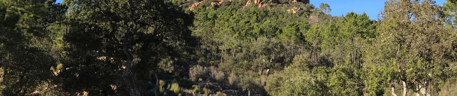
Parcours découverte en ligne depuis le col d’Auriasque dans l’Esterel 20 km
Photos


Positioning
Country:
France
Region :
Provence-Alpes-Côte d'Azur
Department/Province :
Var
Municipality :
Fréjus
Location:
Unknown
Start:(Dec)
Start:(UTM)
320351 ; 4818025 (32T) N.
Comments
Belle traversée du massif de l’Esterel depuis le Col d’Auriasque vers La Bouverie. Parcours avec des sentiers caillouteux, des pistes et des passages en sous bois. Quelques passages techniques délicats et de beaux raidillons à grimper.