


Chantemelle

Airelle
User
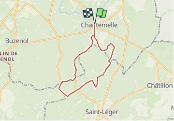

Length
12.2 km

Max alt
366 m

Uphill gradient
230 m
Km-Effort
15.2 km

Min alt
265 m

Downhill gradient
230 m
Boucle
Yes
Creation date :
2023-11-19 12:35:48.0
Updated on :
2023-11-19 15:18:43.697

FREE GPS app for hiking
 SityTrail
IGN / Geographical institutes
SityTrail Plus
The world is yours!
About
Trail of 12.2 km to be discovered at Wallonia, Luxembourg, Étalle. This trail is proposed by Airelle.
Positioning
Country:
Belgium
Region :
Wallonia
Department/Province :
Luxembourg
Municipality :
Étalle
Location:
Chantemelle
Start:(Dec)
Start:(UTM)
691431 ; 5503527 (31U) N.
Comments