


PR_56_Pont-Scorff_AA_01_St-Urchaud_Circuit1b_20231125

patrickdanilo
User
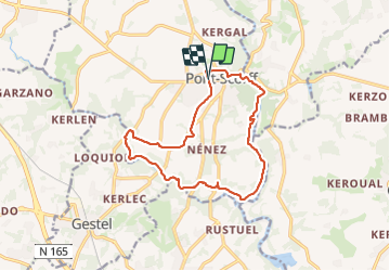

Length
13.5 km

Max alt
48 m

Uphill gradient
203 m
Km-Effort
16.2 km

Min alt
-1 m

Downhill gradient
204 m
Boucle
Yes
Creation date :
2023-11-25 08:32:53.262
Updated on :
2025-07-28 13:03:19.587
3h41
Difficulty : Difficult

FREE GPS app for hiking
 SityTrail
IGN / Geographical institutes
SityTrail Plus
The world is yours!
About
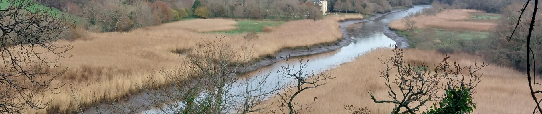
Trail Walking of 13.5 km to be discovered at Brittany, Morbihan, Pont-Scorff. This trail is proposed by patrickdanilo.
Description
Randonnée Marche de 13,6 km à découvrir à Bretagne, Morbihan, Pont-Scorff. Cette randonnée est proposée par patrickdanilo.
Photos


26 photos in total. Please click on a photo to see them all in the gallery.
Positioning
Country:
France
Region :
Brittany
Department/Province :
Morbihan
Municipality :
Pont-Scorff
Location:
Unknown
Start:(Dec)
Start:(UTM)
469686 ; 5297978 (30T) N.
Comments