Trail Walking Naveil - Naveil - Photo
 guydu41
guydu41

User

© OpenStreetMap contributors
Length
Length
9.8 km
Max alt
Max alt
129 m
Uphill gradient
Uphill gradient
113 m
Km-Effort
Km-Effort  
11.3 km
Min alt
Min alt
73 m
Downhill gradient
Downhill gradient
113 m
Boucle
Boucle
Yes
Creation date :
2023-11-25 12:40:13.612
Updated on :
2023-11-26 19:33:27.158

(0 Reviews)

Walking
Walking
2h33
Difficulty : Easy

Scan this QR Code to open this trail in the SityTrail application

FREE GPS app for hiking

Logo SityTrail SityTrail

IGN / Geographical institutes

Download SityTrail from the App Store Download SityTrail from Google Play

Logo SityTrail SityTrail World

The world is yours!

Download SityTrail from the App Store Download SityTrail from Google Play Download SityTrail on Huawei AppGallery

About

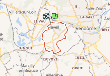
Trail Walking of 9.8 km to be discovered at Centre-Loire Valley, Loir-et-Cher, Naveil. This trail is proposed by guydu41.

Description

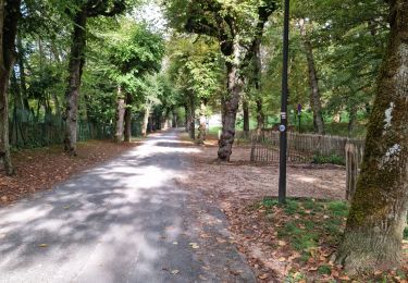
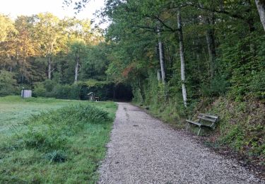
Circuit à travers bois et champs autour du village de Naveil.
Il longe le Loir, puis la petite ligne TER (Paris - Tours), emprunte un chemin qui descend vers une route communale passant sous un imposant pont supportant la rocade.
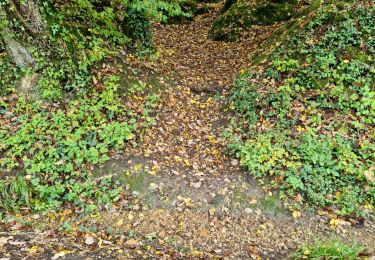
Il permet de visiter un site archéologique comportant un polissoir, emprunte un sentier pentu longeant la ligne TER, passe dessous pour déboucher sur la vallée du Loir.
Retour à travers champs vers le parking de départ.

Elevation profile

Photos

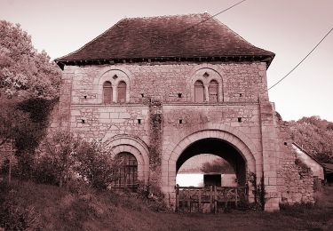
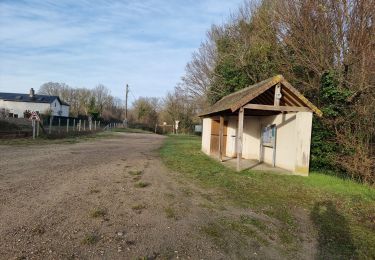
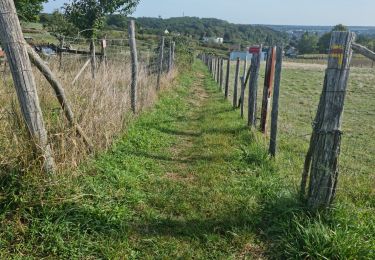
28 photos in total. Please click on a photo to see them all in the gallery.

Positioning

Country:
France
Region :
Centre-Loire Valley
Department/Province :
Loir-et-Cher
Municipality :
Naveil
Location:
Unknown
Start:(UTM)
352219 ; 5295658 (31T) N.

Trails nearby

Trail On foot Villiers-sur-Loir - Circuit des Côteaux - Photo
On foot
PRO

On foot

Easy
Villiers-sur-Loir, Centre-Loire Valley, Loir-et-Cher, France
9.4 km | 11 km-effort
2h 29min
Yes
Trail Walking Sainte-Anne - Sainte-Anne  - Photo
Walking
guydu41

Walking

Medium
Sainte-Anne, Centre-Loire Valley, Loir-et-Cher, France
7.4 km | 8.3 km-effort
1h 52min
Yes
Trail Walking Marcilly-en-Beauce - Varennes - Photo
Walking
guydu41

Walking

Easy
Marcilly-en-Beauce, Centre-Loire Valley, Loir-et-Cher, France
7.9 km | 9.1 km-effort
2h 3min
Yes
Trail Walking Vendôme - Vendôme - Villiers-sur-Loir  - Photo
Walking
guydu41

Walking

Medium
Vendôme, Centre-Loire Valley, Loir-et-Cher, France
13.2 km | 15.6 km-effort
3h 32min
Yes
Trail Walking Vendôme - Vendôme Sud - Photo
Walking
guydu41

Walking

Easy
Vendôme, Centre-Loire Valley, Loir-et-Cher, France
5.1 km | 6 km-effort
1h 21min
Yes
Trail Walking Vendôme - Vendôme Nord - Photo
Walking
guydu41

Walking

Medium
Vendôme, Centre-Loire Valley, Loir-et-Cher, France
9.6 km | 11.5 km-effort
2h 37min
Yes
Trail Walking Vendôme - Découverte de Vendôme  - Photo
Walking
guydu41

Walking

Easy
Vendôme, Centre-Loire Valley, Loir-et-Cher, France
8.5 km | 9.1 km-effort
2h 4min
Yes
Trail Walking Thoré-la-Rochette - Thoré-la-Rochette  - Photo
Walking
guydu41

Walking

Medium
Thoré-la-Rochette, Centre-Loire Valley, Loir-et-Cher, France
9.5 km | 11.1 km-effort
2h 31min
Yes
Trail Walking Vendôme - Petit parcours dans la partie Sud-est du Bois de l'Oratoire - Photo
Walking
guydu41

Walking

Easy
Vendôme, Centre-Loire Valley, Loir-et-Cher, France
4.2 km | 5 km-effort
1h 13min
Yes


Close
My subscriptions