


le Caramy

cousam
User
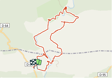

Length
13 km

Max alt
428 m

Uphill gradient
307 m
Km-Effort
17.1 km

Min alt
279 m

Downhill gradient
311 m
Boucle
Yes
Creation date :
2023-11-26 08:01:36.325
Updated on :
2023-11-27 06:09:34.174
6h41
Difficulty : Medium

FREE GPS app for hiking
 SityTrail
IGN / Geographical institutes
SityTrail Plus
The world is yours!
About
Trail Walking of 13 km to be discovered at Provence-Alpes-Côte d'Azur, Var, Mazaugues. This trail is proposed by cousam.
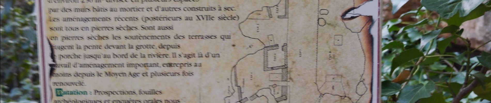
Photos


25 photos in total. Please click on a photo to see them all in the gallery.
Positioning
Country:
France
Region :
Provence-Alpes-Côte d'Azur
Department/Province :
Var
Municipality :
Mazaugues
Location:
Unknown
Start:(Dec)
Start:(UTM)
736087 ; 4805437 (31T) N.
Comments