Mont Aigre depuis le Testanier

GeorgesV.
User
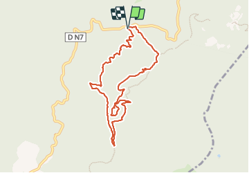

Length
9.2 km

Max alt
444 m

Uphill gradient
340 m
Km-Effort
13.7 km

Min alt
242 m

Downhill gradient
345 m
Boucle
Yes
Creation date :
2023-12-01 07:41:41.0
Updated on :
2023-12-01 11:25:58.976

FREE GPS app for hiking
 SityTrail
IGN / Geographical institutes
SityTrail Plus
The world is yours!
About
Trail of 9.2 km to be discovered at Provence-Alpes-Côte d'Azur, Var, Fréjus. This trail is proposed by GeorgesV..
Positioning
Country:
France
Region :
Provence-Alpes-Côte d'Azur
Department/Province :
Var
Municipality :
Fréjus
Location:
Unknown
Start:(Dec)
Start:(UTM)
321718 ; 4818848 (32T) N.
Comments