


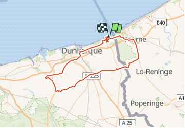
Visite de Bray-Dunes

mathis01
User

Length
102 km

Max alt
37 m

Uphill gradient
349 m
Km-Effort
107 km

Min alt
-4 m

Downhill gradient
349 m
Boucle
Yes
Creation date :
2023-12-02 10:10:50.152
Updated on :
2023-12-02 11:45:20.53
4h37
Difficulty : Very difficult

FREE GPS app for hiking
 SityTrail
IGN / Geographical institutes
SityTrail Plus
The world is yours!
About
Trail Road bike of 102 km to be discovered at Hauts-de-France, Nord, Bray-Dunes. This trail is proposed by mathis01.
Positioning
Country:
France
Region :
Hauts-de-France
Department/Province :
Nord
Municipality :
Bray-Dunes
Location:
Unknown
Start:(Dec)
Start:(UTM)
466771 ; 5657834 (31U) N.
Comments