


Castelnau de Lévis

chripaci
User
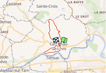

Length
11.2 km

Max alt
274 m

Uphill gradient
247 m
Km-Effort
14.5 km

Min alt
140 m

Downhill gradient
248 m
Boucle
Yes
Creation date :
2023-12-03 07:55:25.0
Updated on :
2023-12-03 18:59:13.723
2h33
Difficulty : Easy

FREE GPS app for hiking
 SityTrail
IGN / Geographical institutes
SityTrail Plus
The world is yours!
About
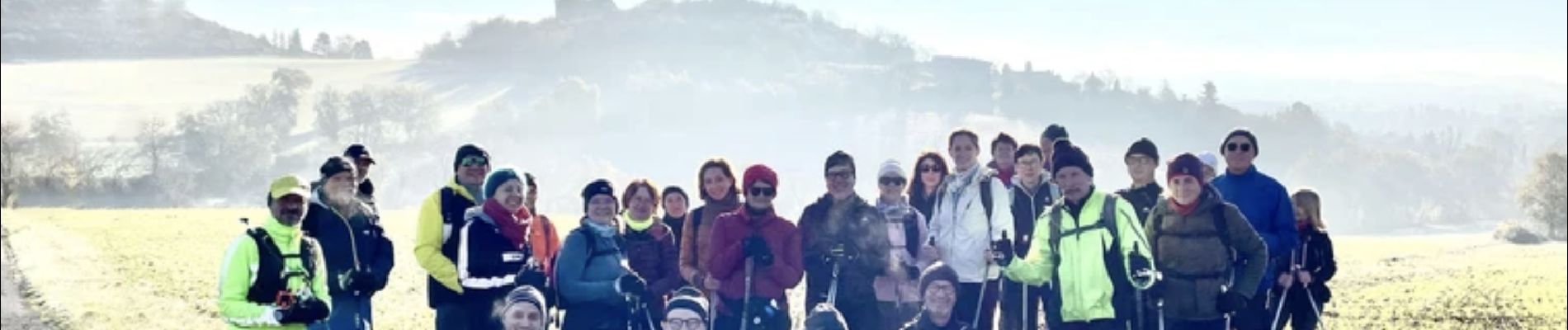
Trail Nordic walking of 11.2 km to be discovered at Occitania, Tarn, Castelnau-de-Lévis. This trail is proposed by chripaci.
Description
belle marche à partir de Castelnau de Levis avec de beaux points de vue sur la vallée du Tarn et sur la tour du château.
Photos

Positioning
Country:
France
Region :
Occitania
Department/Province :
Tarn
Municipality :
Castelnau-de-Lévis
Location:
Unknown
Start:(Dec)
Start:(UTM)
426428 ; 4865393 (31T) N.
Comments