


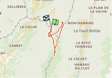

12.2 km | 28 km-effort

User


FREE GPS app for hiking
 SityTrail
IGN / Geographical institutes
SityTrail World
The world is yours!
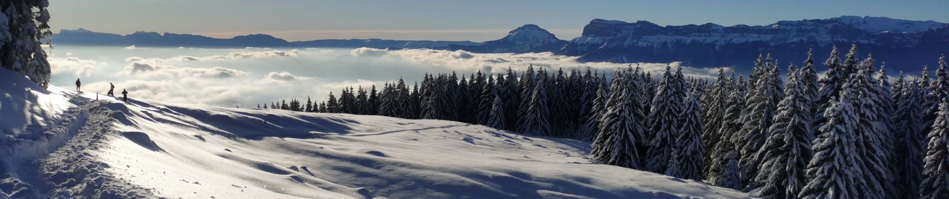
Trail Snowshoes of 10.3 km to be discovered at Auvergne-Rhône-Alpes, Isère, Crêts-en-Belledonne. This trail is proposed by Zasa .
Randonnée sympa avec de magnifiques points de vue. Sans difficultés.


Walking
Walking

Mountain bike
Walking
Walking

Other activity

Winter sports
Walking
Walking