


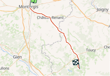
Montargis / St Sauveur en Puisaye

Catherine de Brunoy
User

Length
61 km

Max alt
276 m

Uphill gradient
589 m
Km-Effort
69 km

Min alt
87 m

Downhill gradient
416 m
Boucle
No
Creation date :
2023-12-09 11:18:35.0
Updated on :
2023-12-09 11:18:37.401
28m
Difficulty : Very difficult

FREE GPS app for hiking
 SityTrail
IGN / Geographical institutes
SityTrail Plus
The world is yours!
About
Trail Hybrid bike of 61 km to be discovered at Centre-Loire Valley, Loiret, Montargis. This trail is proposed by Catherine de Brunoy.
Description
En vélo de la gare de Montargis à St Sauveur en Puizaye visite de la maison et du musée de Colette visite de Guedelon
Positioning
Country:
France
Region :
Centre-Loire Valley
Department/Province :
Loiret
Municipality :
Montargis
Location:
Unknown
Start:(Dec)
Start:(UTM)
480911 ; 5315887 (31T) N.
Comments