


Tuc de l’Étang

lebarça
User
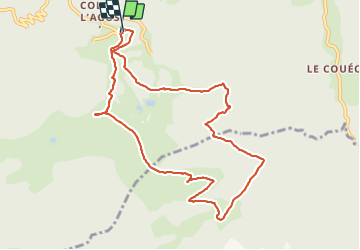

Length
11 km

Max alt
1806 m

Uphill gradient
683 m
Km-Effort
20 km

Min alt
1327 m

Downhill gradient
681 m
Boucle
Yes
Creation date :
2023-12-10 08:18:49.0
Updated on :
2023-12-10 13:21:21.752

FREE GPS app for hiking
 SityTrail
IGN / Geographical institutes
SityTrail Plus
The world is yours!
About
Trail of 11 km to be discovered at Occitania, Haute-Garonne, Boutx. This trail is proposed by lebarça.
Positioning
Country:
France
Region :
Occitania
Department/Province :
Haute-Garonne
Municipality :
Boutx
Location:
Unknown
Start:(Dec)
Start:(UTM)
317990 ; 4753526 (31T) N.
Comments