


Vercors Pierre Chauve

c.gourme
User
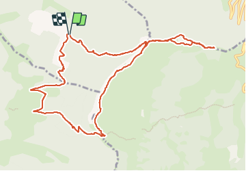

Length
13.3 km

Max alt
1299 m

Uphill gradient
861 m
Km-Effort
25 km

Min alt
541 m

Downhill gradient
867 m
Boucle
Yes
Creation date :
2023-12-12 08:04:16.0
Updated on :
2023-12-12 19:26:19.968
5h37
Difficulty : Medium

FREE GPS app for hiking
 SityTrail
IGN / Geographical institutes
SityTrail Plus
The world is yours!
About
Trail Walking of 13.3 km to be discovered at Auvergne-Rhône-Alpes, Drôme, Saint-Vincent-la-Commanderie. This trail is proposed by c.gourme.
Description
Pour le parking suivre la direction Les Condamines
durée pour monter au sommet :3h
dans l'autre sens :4h
Attention faire quand il n'y a plus d'animal.. Présence de barbelé à emjamber
Positioning
Country:
France
Region :
Auvergne-Rhône-Alpes
Department/Province :
Drôme
Municipality :
Saint-Vincent-la-Commanderie
Location:
Unknown
Start:(Dec)
Start:(UTM)
668916 ; 4976242 (31T) N.
Comments