


Tête de veau

psesjs
User
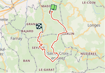

Length
13 km

Max alt
654 m

Uphill gradient
437 m
Km-Effort
19 km

Min alt
353 m

Downhill gradient
491 m
Boucle
No
Creation date :
2023-12-13 09:20:01.479
Updated on :
2023-12-13 15:37:13.477
4h16
Difficulty : Medium

FREE GPS app for hiking
 SityTrail
IGN / Geographical institutes
SityTrail Plus
The world is yours!
About
Trail Walking of 13 km to be discovered at Auvergne-Rhône-Alpes, Loire, Châteauneuf. This trail is proposed by psesjs.
Positioning
Country:
France
Region :
Auvergne-Rhône-Alpes
Department/Province :
Loire
Municipality :
Châteauneuf
Location:
Unknown
Start:(Dec)
Start:(UTM)
627850 ; 5041311 (31T) N.
Comments