


parcours_entrainement-3190653-1702497388-27

topolino
User
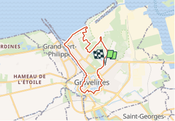

Length
13.1 km

Max alt
7 m

Uphill gradient
57 m
Km-Effort
13.9 km

Min alt
-3 m

Downhill gradient
57 m
Boucle
Yes
Creation date :
2023-12-13 20:17:16.105
Updated on :
2023-12-15 19:09:16.781
--
Difficulty : Unknown

FREE GPS app for hiking
 SityTrail
IGN / Geographical institutes
SityTrail Plus
The world is yours!
About
Trail Running of 13.1 km to be discovered at Hauts-de-France, Nord, Gravelines. This trail is proposed by topolino.
Positioning
Country:
France
Region :
Hauts-de-France
Department/Province :
Nord
Municipality :
Gravelines
Location:
Unknown
Start:(Dec)
Start:(UTM)
439434 ; 5649574 (31U) N.
Comments