


TRK000

ARVIEU
User
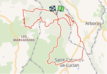

Length
14.8 km

Max alt
455 m

Uphill gradient
588 m
Km-Effort
23 km

Min alt
153 m

Downhill gradient
595 m
Boucle
Yes
Creation date :
2023-12-14 17:28:30.37
Updated on :
2023-12-14 17:32:57.946
4h00
Difficulty : Easy

FREE GPS app for hiking
 SityTrail
IGN / Geographical institutes
SityTrail Plus
The world is yours!
About
Trail Walking of 14.8 km to be discovered at Occitania, Hérault, Saint-Saturnin-de-Lucian. This trail is proposed by ARVIEU.
Description
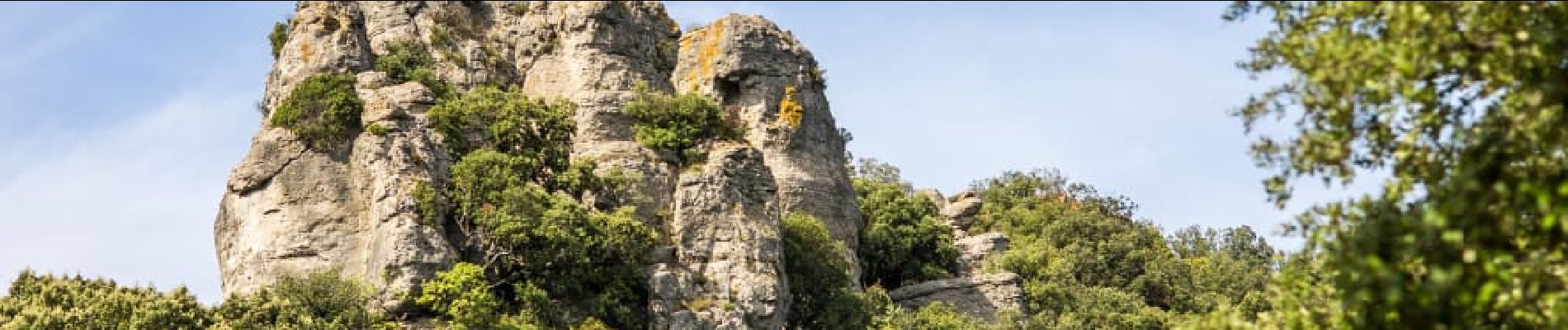
au Départ de Saint Saturnin de Lucian
Photos

Positioning
Country:
France
Region :
Occitania
Department/Province :
Hérault
Municipality :
Saint-Saturnin-de-Lucian
Location:
Unknown
Start:(Dec)
Start:(UTM)
537431 ; 4840241 (31T) N.
Comments