


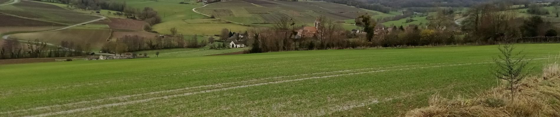
La Chapelle-Monthodon du 14-12-2023

VANDERPUTTENMi
User GUIDE
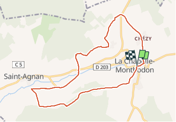

Length
9.3 km

Max alt
217 m

Uphill gradient
204 m
Km-Effort
12 km

Min alt
105 m

Downhill gradient
206 m
Boucle
Yes
Creation date :
2023-12-14 13:02:33.724
Updated on :
2023-12-14 18:35:39.091
2h07
Difficulty : Difficult

FREE GPS app for hiking
 SityTrail
IGN / Geographical institutes
SityTrail Plus
The world is yours!
About
Trail Walking of 9.3 km to be discovered at Hauts-de-France, Aisne, Vallées-en-Champagne. This trail is proposed by VANDERPUTTENMi.
Photos

Positioning
Country:
France
Region :
Hauts-de-France
Department/Province :
Aisne
Municipality :
Vallées-en-Champagne
Location:
La Chapelle-Monthodon
Start:(Dec)
Start:(UTM)
546380 ; 5430220 (31U) N.
Comments