


moustier mont deniers 18k 100m

Danielba
User GUIDE
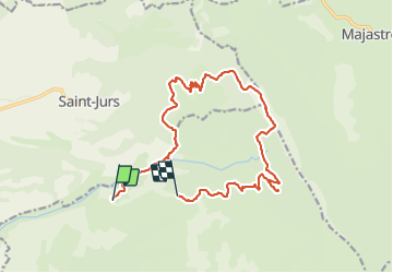

Length
17.5 km

Max alt
1739 m

Uphill gradient
944 m
Km-Effort
30 km

Min alt
890 m

Downhill gradient
843 m
Boucle
No
Creation date :
2023-12-12 07:22:27.717
Updated on :
2023-12-15 17:12:42.18
7h53
Difficulty : Very difficult

FREE GPS app for hiking
 SityTrail
IGN / Geographical institutes
SityTrail Plus
The world is yours!
About
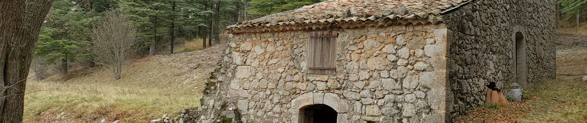
Trail Walking of 17.5 km to be discovered at Provence-Alpes-Côte d'Azur, Alpes-de-Haute-Provence, Moustiers-Sainte-Marie. This trail is proposed by Danielba .
Photos


Positioning
Country:
France
Region :
Provence-Alpes-Côte d'Azur
Department/Province :
Alpes-de-Haute-Provence
Municipality :
Moustiers-Sainte-Marie
Location:
Unknown
Start:(Dec)
Start:(UTM)
275627 ; 4861880 (32T) N.
Comments