Trail Walking Saint-Firmin-des-Prés - Saint-Firmin-des-Prés - Photo
 guydu41
guydu41

User

© OpenStreetMap contributors
Length
Length
8.9 km
Max alt
Max alt
124 m
Uphill gradient
Uphill gradient
80 m
Km-Effort
Km-Effort  
9.9 km
Min alt
Min alt
80 m
Downhill gradient
Downhill gradient
79 m
Boucle
Boucle
Yes
Creation date :
2023-12-16 12:17:06.778
Updated on :
2023-12-16 18:49:16.34

(0 Reviews)

Walking
Walking
1h58
Difficulty : Easy

Scan this QR Code to open this trail in the SityTrail application

FREE GPS app for hiking

Logo SityTrail SityTrail

IGN / Geographical institutes

Download SityTrail from the App Store Download SityTrail from Google Play

Logo SityTrail SityTrail World

The world is yours!

Download SityTrail from the App Store Download SityTrail from Google Play Download SityTrail on Huawei AppGallery

About

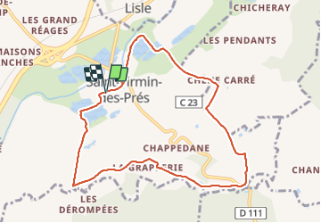
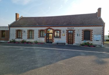
Trail Walking of 8.9 km to be discovered at Centre-Loire Valley, Loir-et-Cher, Saint-Firmin-des-Prés. This trail is proposed by guydu41.

Description

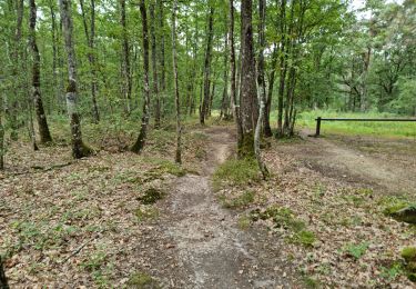
Ce circuit proposé par la commune de Saint-Firmin-des-Prés est balisé par un trait violet sur fond blanc.
Le départ se fait depuis le parking face au Pôle culturel Rue de la Mouline.
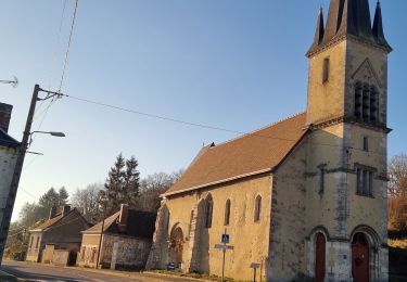
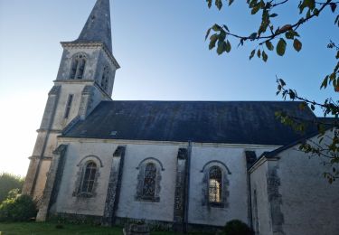
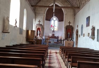
Plusieurs petits panneaux explicatif jalonne ce charmant parcours à travers champs et à côté de plusieurs étangs.

Elevation profile

Photos

Positioning

Country:
France
Region :
Centre-Loire Valley
Department/Province :
Loir-et-Cher
Municipality :
Saint-Firmin-des-Prés
Location:
Unknown
Start:(UTM)
358570 ; 5300378 (31T) N.

Trails nearby

Trail Walking Lisle - Lisle - Bord du Loir - Photo
Walking
guydu41

Walking

Easy
Lisle, Centre-Loire Valley, Loir-et-Cher, France
8.9 km | 9.5 km-effort
2h 9min
Yes
Trail Walking Rahart - Rahart - Photo
Walking
guydu41

Walking

Easy
Rahart, Centre-Loire Valley, Loir-et-Cher, France
8.1 km | 9.3 km-effort
2h 6min
Yes
Trail Walking Lisle - Lisle - Bois de l'Epau - Photo
Walking
guydu41

Walking

Easy
Lisle, Centre-Loire Valley, Loir-et-Cher, France
8.9 km | 10.2 km-effort
2h 19min
Yes
Trail Walking Renay - Renay - Photo
Walking
guydu41

Walking

Easy
Renay, Centre-Loire Valley, Loir-et-Cher, France
13.8 km | 15.8 km-effort
3h 35min
Yes
Trail Walking Saint-Ouen - Parcours nature à Saint-Ouen (41100) - Photo
Walking
guydu41

Walking

Easy
Saint-Ouen, Centre-Loire Valley, Loir-et-Cher, France
16.1 km | 19 km-effort
4h 3min
Yes
Trail Walking Saint-Ouen - Saint-Ouen - Circuit découverte 2 - Photo
Walking
guydu41

Walking

Very easy
Saint-Ouen, Centre-Loire Valley, Loir-et-Cher, France
10.5 km | 12.4 km-effort
3h 16min
Yes
Trail Walking Vendôme - Forêt de Vendôme Circuit 2 - Photo
Walking
guydu41

Walking

Very easy
Vendôme, Centre-Loire Valley, Loir-et-Cher, France
4 km | 4.4 km-effort
1h 7min
Yes
Trail Walking Saint-Firmin-des-Prés - St Firmin Mjo - Photo
Walking
christ41

Walking

Easy
Saint-Firmin-des-Prés, Centre-Loire Valley, Loir-et-Cher, France
16 km | 17.9 km-effort
3h 9min
Yes
Trail Walking Lisle - Rando de lisle - Photo
Walking
Jean LABADIE

Walking

Medium
(1)
Lisle, Centre-Loire Valley, Loir-et-Cher, France
18.7 km | 21 km-effort
4h 21min
Yes


Close
My subscriptions