Trail Walking Limours - Essonne_Limours=>Chaumusson=>Pecqueuse=>Villevert=>Limours - Photo

Essonne_Limours=>Chaumusson=>Pecqueuse=>Villevert=>Limours

© OpenStreetMap contributors
Length
Length
11.5 km
Max alt
Max alt
177 m
Uphill gradient
Uphill gradient
138 m
Km-Effort
Km-Effort  
13.3 km
Min alt
Min alt
122 m
Downhill gradient
Downhill gradient
138 m
Boucle
Boucle
Yes
Creation date :
2023-12-16 12:33:49.259
Updated on :
2024-01-02 17:36:01.647

(0 Reviews)

Walking
Walking
3h01
Difficulty : Medium

Scan this QR Code to open this trail in the SityTrail application

FREE GPS app for hiking

Logo SityTrail SityTrail

IGN / Geographical institutes

Download SityTrail from the App Store Download SityTrail from Google Play

Logo SityTrail SityTrail World

The world is yours!

Download SityTrail from the App Store Download SityTrail from Google Play Download SityTrail on Huawei AppGallery

About

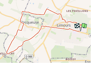
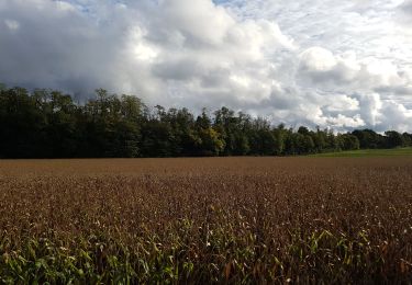
Trail Walking of 11.5 km to be discovered at Ile-de-France, Essonne, Limours. This trail is proposed by BMorin91470.

Description

Randonnée moyenne avec quelques dénivelés mais peu abruptes.
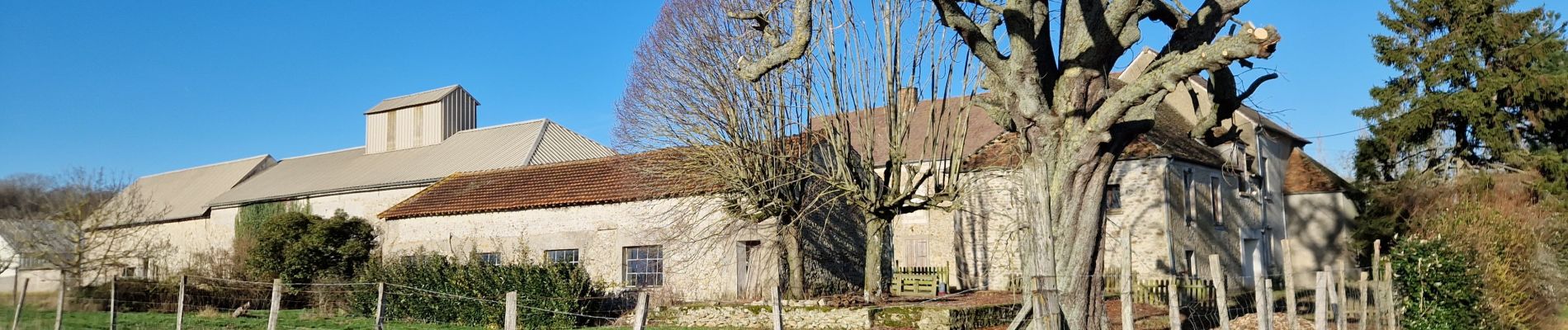
Au départ du parking de La Scène à Limours, prendre la direction du bois de Limours, le longer vers la gauche et rejoindre le cimetière de Limours par la rue de Marcoussis et la rue des Lavandiers; prendre la sente piétonne à gauche juste avant le cimetière et rejoindre le Chemin de la Butte Verte qui monte à au hameau de Chaumusson. Traverser Chaumusson et rejoindre par la ferme de Pommeret puis se diriger, à gauche, vers la Maison du Garde et de là prendre à droite sur 1 km et prendre à gauche, à travers bois, la direction de Pecqueuse. Traverser vers la gauche une partie du centre du village et prendre à droite la rue des Bleuets et poursuivre le chemin qui rejoint plus lion la route de Bonnelles. Suivre cette route pendant 1,5 Km jusqu'au hameau de Villevert. De là, prendre la rue des Bois qui se prolonge par un chemin qui rejoint, par le vallon de la Gloriette, (2 km) l'entrée de Pecqueuse sur le CV8 qu'il faut traverser pour prendre la sente qui rejoint la D24 et l'entrée de Limours. Rejoindre le parking de la Scène (1,5 km) par la route de Rambouillet, l'Avenue de la Gare puis la route d'Arpajon.


[Rando réalisée le 16/12/2023]

Elevation profile

Photos

Positioning

Country:
France
Region :
Ile-de-France
Department/Province :
Essonne
Municipality :
Limours
Location:
Unknown
Start:(UTM)
432767 ; 5388151 (31U) N.

Trails nearby

Trail Walking Bonnelles - _Le rallye de Bonnelles à Rochefort - Photo
Walking
GUIDE+

Walking

Medium
(10)
Bonnelles, Ile-de-France, Yvelines, France
14.1 km | 16.4 km-effort
3h 30min
Yes
Trail Walking Choisel - _Si Choisel m'était conté - Photo
Walking
GUIDE+

Walking

Easy
(8)
Choisel, Ile-de-France, Yvelines, France
5.6 km | 6.6 km-effort
1h 27min
Yes
Trail Walking Limours - Essonne_Tour_des_Fermes_de_la_Prédecelle - Photo
Walking
BMorin91470

Walking

Very easy
(1)
Limours, Ile-de-France, Essonne, France
12.9 km | 14.3 km-effort
3h 43min
Yes
Trail Walking Gometz-le-Châtel - Autour de Gometz le Châtel - Photo
Walking
tracegps

Walking

Medium
(1)
Gometz-le-Châtel, Ile-de-France, Essonne, France
7.8 km | 10.6 km-effort
2h 30min
Yes
Trail Walking Limours - Essonne_RD_Limours=>Viaduc=>Prédecelle=>Chaumusson - Photo
Walking
BMorin91470

Walking

Easy
(1)
Limours, Ile-de-France, Essonne, France
7.4 km | 8.4 km-effort
2h 30min
Yes
Trail Walking Limours - 20210319_Limours_Viaduc_Prédecelle_Amont - Photo
Walking
BMorin91470

Walking

Easy
(1)
Limours, Ile-de-France, Essonne, France
8.7 km | 9.9 km-effort
2h 30min
Yes
Trail Walking Pecqueuse - 20191019_Tour_des_Fermes_réalisé - Photo
Walking
BMorin91470

Walking

Very easy
(1)
Pecqueuse, Ile-de-France, Essonne, France
13.8 km | 15.2 km-effort
3h 43min
Yes
Trail Walking Gometz-le-Châtel - Gometz-le-Chatel.11022024 - Photo
Walking
aucamus

Walking

Medium
(1)
Gometz-le-Châtel, Ile-de-France, Essonne, France
17.9 km | 24 km-effort
5h 28min
Yes
Trail Mountain bike Limours - St Arnoult 33km-2h30 - Photo
Mountain bike
delalex

Mountain bike

Difficult
(1)
Limours, Ile-de-France, Essonne, France
34 km | 39 km-effort
2h 33min
Yes


Close
My subscriptions