


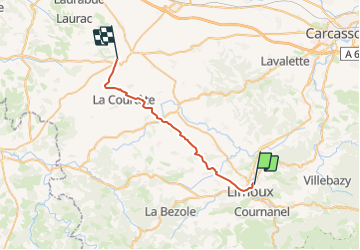
limoux - fanjeaux

totoarzens
User

Length
28 km

Max alt
408 m

Uphill gradient
547 m
Km-Effort
35 km

Min alt
166 m

Downhill gradient
376 m
Boucle
No
Creation date :
2023-12-19 08:42:14.451
Updated on :
2023-12-19 08:45:20.34
7h50
Difficulty : Very difficult

FREE GPS app for hiking
 SityTrail
IGN / Geographical institutes
SityTrail Plus
The world is yours!
About
Trail Walking of 28 km to be discovered at Occitania, Aude, Limoux. This trail is proposed by totoarzens.
Positioning
Country:
France
Region :
Occitania
Department/Province :
Aude
Municipality :
Limoux
Location:
Unknown
Start:(Dec)
Start:(UTM)
436788 ; 4767894 (31T) N.
Comments