


le chemin de la Peyrouse

Mascart
User
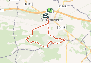

Length
7.4 km

Max alt
189 m

Uphill gradient
153 m
Km-Effort
9.4 km

Min alt
80 m

Downhill gradient
144 m
Boucle
No
Creation date :
2023-12-19 12:42:59.435
Updated on :
2023-12-19 15:39:48.363
2h28
Difficulty : Easy

FREE GPS app for hiking
 SityTrail
IGN / Geographical institutes
SityTrail Plus
The world is yours!
About
Trail Walking of 7.4 km to be discovered at Occitania, Aude, Fontcouverte. This trail is proposed by Mascart.
Description
Fontcouverte
Positioning
Country:
France
Region :
Occitania
Department/Province :
Aude
Municipality :
Fontcouverte
Location:
Unknown
Start:(Dec)
Start:(UTM)
474428 ; 4779822 (31T) N.
Comments