


231220 Barnas

Rudy07
User
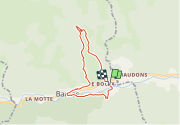

Length
6.7 km

Max alt
638 m

Uphill gradient
245 m
Km-Effort
9.9 km

Min alt
438 m

Downhill gradient
241 m
Boucle
Yes
Creation date :
2023-12-20 12:35:03.811
Updated on :
2023-12-20 16:55:42.757
2h15
Difficulty : Medium

FREE GPS app for hiking
 SityTrail
IGN / Geographical institutes
SityTrail Plus
The world is yours!
About
Trail Walking of 6.7 km to be discovered at Auvergne-Rhône-Alpes, Ardèche, Barnas. This trail is proposed by Rudy07.
Description
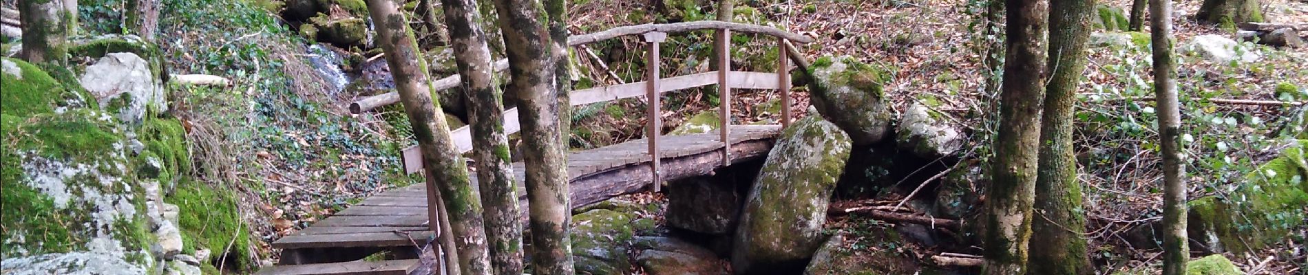
Départ du pont de Bouix
Photos


Positioning
Country:
France
Region :
Auvergne-Rhône-Alpes
Department/Province :
Ardèche
Municipality :
Barnas
Location:
Unknown
Start:(Dec)
Start:(UTM)
593549 ; 4946910 (31T) N.
Comments