


pont de la flee

les randos d'Olivier
partout a pied et en moto

Length
7.6 km

Max alt
1342 m

Uphill gradient
414 m
Km-Effort
13.2 km

Min alt
999 m

Downhill gradient
414 m
Boucle
Yes
Creation date :
2023-12-24 14:55:52.829
Updated on :
2023-12-24 15:20:30.961
2h59
Difficulty : Difficult

FREE GPS app for hiking
 SityTrail
IGN / Geographical institutes
SityTrail Plus
The world is yours!
About
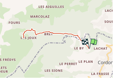
Trail Walking of 7.6 km to be discovered at Auvergne-Rhône-Alpes, Upper Savoy, Cordon. This trail is proposed by les randos d'Olivier.

Positioning
Country:
France
Region :
Auvergne-Rhône-Alpes
Department/Province :
Upper Savoy
Municipality :
Cordon
Location:
Unknown
Start:(Dec)
Start:(UTM)
314050 ; 5088771 (32T) N.
Comments