


Cartonné. Glenat

Papou63patrick
User
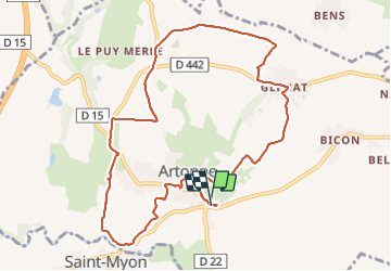

Length
10.9 km

Max alt
524 m

Uphill gradient
235 m
Km-Effort
14 km

Min alt
351 m

Downhill gradient
237 m
Boucle
Yes
Creation date :
2023-12-24 12:32:51.862
Updated on :
2023-12-24 15:26:49.274
2h53
Difficulty : Easy

FREE GPS app for hiking
 SityTrail
IGN / Geographical institutes
SityTrail Plus
The world is yours!
About
Trail Walking of 10.9 km to be discovered at Auvergne-Rhône-Alpes, Puy-de-Dôme, Artonne. This trail is proposed by Papou63patrick.
Photos


Positioning
Country:
France
Region :
Auvergne-Rhône-Alpes
Department/Province :
Puy-de-Dôme
Municipality :
Artonne
Location:
Unknown
Start:(Dec)
Start:(UTM)
511491 ; 5094118 (31T) N.
Comments