


tamar

Bruno566
User
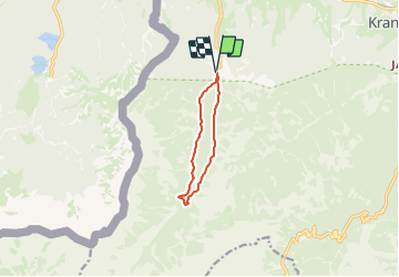

Length
7.2 km

Max alt
1118 m

Uphill gradient
191 m
Km-Effort
9.8 km

Min alt
955 m

Downhill gradient
190 m
Boucle
Yes
Creation date :
2023-12-27 07:24:12.689
Updated on :
2023-12-27 07:24:26.71
2h13
Difficulty : Medium

FREE GPS app for hiking
 SityTrail
IGN / Geographical institutes
SityTrail Plus
The world is yours!
About
Trail Walking of 7.2 km to be discovered at Unknown, Unknown, Kranjska Gora. This trail is proposed by Bruno566.
Positioning
Country:
Slovenia
Region :
Unknown
Department/Province :
Unknown
Municipality :
Kranjska Gora
Location:
Unknown
Start:(Dec)
Start:(UTM)
401959 ; 5147559 (33T) N.
Comments