


Forteresse Cavillore Gourdon

GrouGary
User
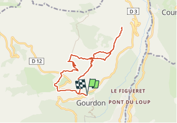

Length
9.4 km

Max alt
1055 m

Uphill gradient
412 m
Km-Effort
14.9 km

Min alt
737 m

Downhill gradient
412 m
Boucle
Yes
Creation date :
2023-12-29 09:43:49.449
Updated on :
2023-12-29 15:38:02.635
3h23
Difficulty : Easy

FREE GPS app for hiking
 SityTrail
IGN / Geographical institutes
SityTrail Plus
The world is yours!
About
Trail Walking of 9.4 km to be discovered at Provence-Alpes-Côte d'Azur, Maritime Alps, Gourdon. This trail is proposed by GrouGary.
Description
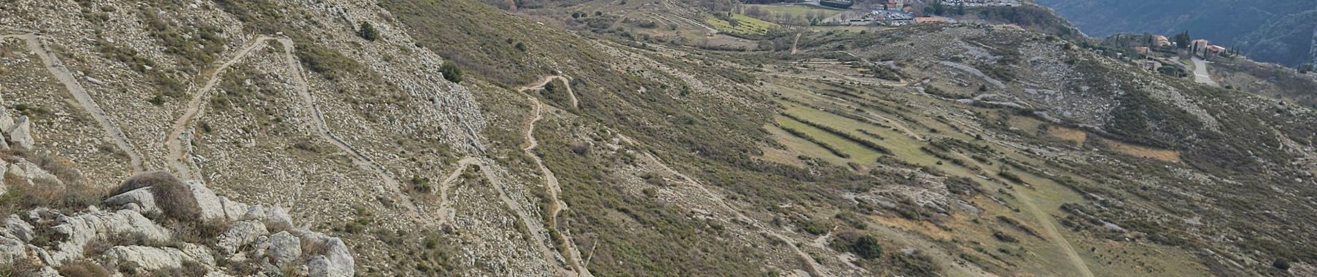
Petite boucle à faire en hiver, sans difficulté technique.
Les derniers mètres d'accès à la "forteresse de Cavillore" sont sécurisés par un filet d'acier ;
Photos


Positioning
Country:
France
Region :
Provence-Alpes-Côte d'Azur
Department/Province :
Maritime Alps
Municipality :
Gourdon
Location:
Unknown
Start:(Dec)
Start:(UTM)
337094 ; 4842933 (32T) N.
Comments