


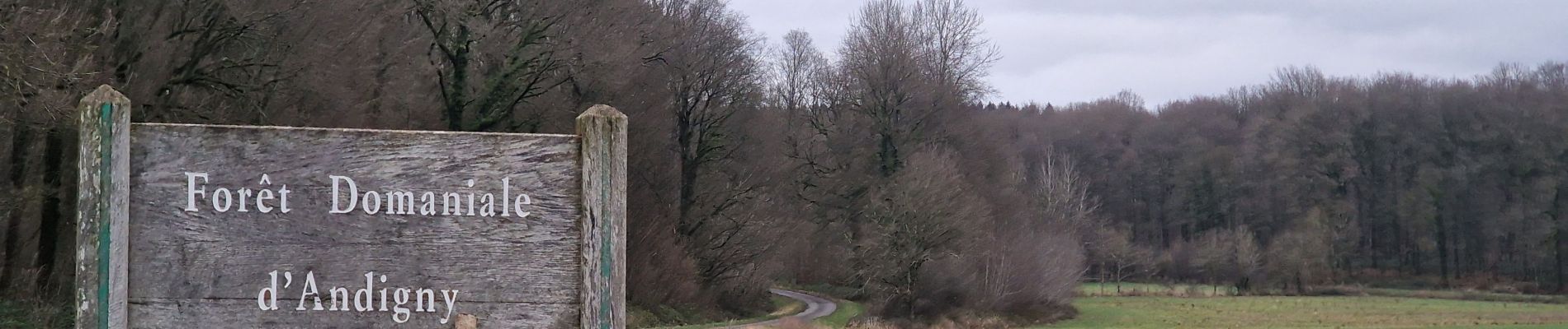
forêt d'andigny

alainwald
User
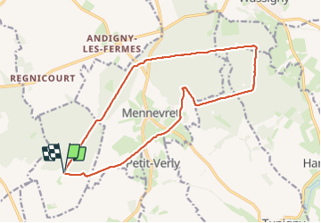

Length
15.7 km

Max alt
184 m

Uphill gradient
209 m
Km-Effort
18.4 km

Min alt
137 m

Downhill gradient
205 m
Boucle
Yes
Creation date :
2023-12-30 13:59:32.228
Updated on :
2023-12-30 17:47:11.406
3h47
Difficulty : Easy

FREE GPS app for hiking
 SityTrail
IGN / Geographical institutes
SityTrail Plus
The world is yours!
About
Trail Walking of 15.7 km to be discovered at Hauts-de-France, Aisne, Seboncourt. This trail is proposed by alainwald.
Description
chemins forestiers
Photos


Positioning
Country:
France
Region :
Hauts-de-France
Department/Province :
Aisne
Municipality :
Seboncourt
Location:
Unknown
Start:(Dec)
Start:(UTM)
537569 ; 5535458 (31U) N.
Comments