


Signe - Jas du Murier

frizou83
User

Length
16.1 km

Max alt
806 m

Uphill gradient
558 m
Km-Effort
24 km

Min alt
388 m

Downhill gradient
558 m
Boucle
Yes
Creation date :
2015-02-27 00:00:00.0
Updated on :
2015-02-27 00:00:00.0
4h56
Difficulty : Medium

FREE GPS app for hiking
 SityTrail
IGN / Geographical institutes
SityTrail Plus
The world is yours!
About
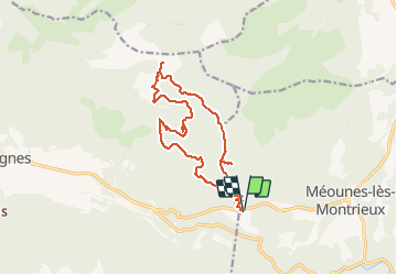
Trail Walking of 16.1 km to be discovered at Provence-Alpes-Côte d'Azur, Var, Méounes-lès-Montrieux. This trail is proposed by frizou83.
Description
Le jas du Murier par la Marseillaise, le haut Cauvet, la Bergerie des Maigres. Retour par Ponchin, le Vallon d'Agnis.
Positioning
Country:
France
Region :
Provence-Alpes-Côte d'Azur
Department/Province :
Var
Municipality :
Méounes-lès-Montrieux
Location:
Unknown
Start:(Dec)
Start:(UTM)
738314 ; 4795959 (31T) N.
Comments