


Laurent

Laurent Alerte 2
User

Length
31 km

Max alt
149 m

Uphill gradient
290 m
Km-Effort
34 km

Min alt
65 m

Downhill gradient
279 m
Boucle
No
Creation date :
2024-01-05 08:50:01.381
Updated on :
2024-01-06 22:19:02.797
6h12
Difficulty : Very difficult

FREE GPS app for hiking
 SityTrail
IGN / Geographical institutes
SityTrail Plus
The world is yours!
About
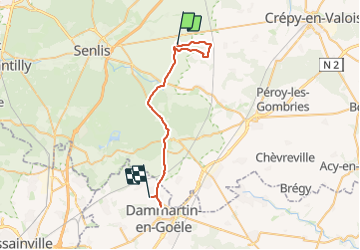
Trail Walking of 31 km to be discovered at Hauts-de-France, Oise, Montépilloy. This trail is proposed by Laurent Alerte 2.
Description
Montepillois
Positioning
Country:
France
Region :
Hauts-de-France
Department/Province :
Oise
Municipality :
Montépilloy
Location:
Unknown
Start:(Dec)
Start:(UTM)
478435 ; 5451046 (31U) N.
Comments