


Arville

Airelle
User
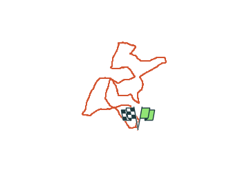

Length
16.7 km

Max alt
518 m

Uphill gradient
365 m
Km-Effort
22 km

Min alt
369 m

Downhill gradient
366 m
Boucle
Yes
Creation date :
2024-01-07 08:06:42.0
Updated on :
2024-01-07 11:53:09.48

FREE GPS app for hiking
 SityTrail
IGN / Geographical institutes
SityTrail Plus
The world is yours!
About
Trail of 16.7 km to be discovered at Wallonia, Luxembourg, Saint-Hubert. This trail is proposed by Airelle.
Positioning
Country:
Belgium
Region :
Wallonia
Department/Province :
Luxembourg
Municipality :
Saint-Hubert
Location:
Unknown
Start:(Dec)
Start:(UTM)
666198 ; 5544737 (31U) N.
Comments