Trail Road bike Saint-Pierre-des-Tripiers - Mont Aigoual - Photo
 GAPIAN43
GAPIAN43

User

© OpenStreetMap contributors
Length
Length
84 km
Max alt
Max alt
1561 m
Uphill gradient
Uphill gradient
1642 m
Km-Effort
Km-Effort  
106 km
Min alt
Min alt
468 m
Downhill gradient
Downhill gradient
1643 m
Boucle
Boucle
Yes
Creation date :
2024-01-09 18:10:40.907
Updated on :
2024-01-09 18:11:47.631

(0 Reviews)

Road bike
Road bike
6h26
Difficulty : Medium

Scan this QR Code to open this trail in the SityTrail application

FREE GPS app for hiking

Logo SityTrail SityTrail

IGN / Geographical institutes

Download SityTrail from the App Store Download SityTrail from Google Play

Logo SityTrail SityTrail World

The world is yours!

Download SityTrail from the App Store Download SityTrail from Google Play Download SityTrail on Huawei AppGallery

About

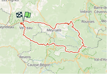
Trail Road bike of 84 km to be discovered at Occitania, Lozère, Saint-Pierre-des-Tripiers. This trail is proposed by GAPIAN43.
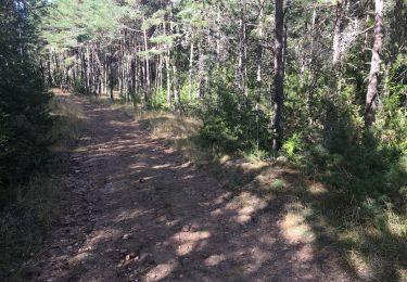
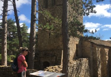
Elevation profile

Positioning

Country:
France
Region :
Occitania
Department/Province :
Lozère
Municipality :
Saint-Pierre-des-Tripiers
Location:
Unknown
Start:(UTM)
523231 ; 4894853 (31T) N.

Trails nearby

Trail Walking Saint-Pierre-des-Tripiers - Cassagnes crête vallée Jonte et Tarn 12,2 km - Photo
Walking
GUIDE
rvapeldo

Walking

Medium
Saint-Pierre-des-Tripiers, Occitania, Lozère, France
12.6 km | 20 km-effort
5h 38min
No
Trail Walking Veyreau - J3 St Jean des Balmes Ermitage St Michel - Photo
Walking
ARPF

Walking

Easy
(2)
Veyreau, Occitania, Aveyron, France
9.6 km | 13.9 km-effort
3h 18min
Yes
Trail Walking Saint-Pierre-des-Tripiers - Les corniches du Méjean - Photo
Walking
ZURMELY

Walking

Medium
(3)
Saint-Pierre-des-Tripiers, Occitania, Lozère, France
6 km | 9.5 km-effort
2h 31min
Yes
Trail Walking Saint-Pierre-des-Tripiers - LL34-Corniches du Méjean - Photo
Walking
alainandrejoly

Walking

Difficult
(1)
Saint-Pierre-des-Tripiers, Occitania, Lozère, France
12.1 km | 25 km-effort
4h 51min
Yes
Trail Walking Saint-Pierre-des-Tripiers - vautour - Photo
Walking
aezret

Walking

Medium
(1)
Saint-Pierre-des-Tripiers, Occitania, Lozère, France
7.1 km | 12.3 km-effort
2h 59min
Yes
Trail Walking Massegros Causses Gorges - Baousse del fiel - Photo
Walking
gdela

Walking

Medium
Massegros Causses Gorges, Occitania, Lozère, France
8.2 km | 12.2 km-effort
1h 56min
Yes
Trail Walking Saint-Pierre-des-Tripiers - Boucle Cassagnes - Gorges Jonte - Photo
Walking
prous31

Walking

Easy
(1)
Saint-Pierre-des-Tripiers, Occitania, Lozère, France
8.2 km | 13.7 km-effort
2h 57min
Yes
Trail Walking Saint-Pierre-des-Tripiers - Les corniches du Méjean (Jonte) et du Tarn au départ de Cassagnes - Photo
Walking
PiloudeBamako

Walking

Difficult
Saint-Pierre-des-Tripiers, Occitania, Lozère, France
13.1 km | 21 km-effort
3h 31min
Yes
Trail Walking Veyreau - Corniche du Causse noir (Le point sublime)  - Photo
Walking
PiloudeBamako

Walking

Medium
Veyreau, Occitania, Aveyron, France
12 km | 16.6 km-effort
3h 12min
Yes


Close
My subscriptions