


La vallée de l'Ognon et l'Abbaye de Bellefontaine

gerardmicheline
User
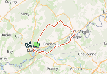

Length
22 km

Max alt
358 m

Uphill gradient
386 m
Km-Effort
27 km

Min alt
198 m

Downhill gradient
391 m
Boucle
Yes
Creation date :
2024-01-10 13:54:00.538
Updated on :
2024-01-10 15:31:11.242
6h14
Difficulty : Very difficult

FREE GPS app for hiking
 SityTrail
IGN / Geographical institutes
SityTrail Plus
The world is yours!
About
Trail Walking of 22 km to be discovered at Bourgogne-Franche-Comté, Haute-Saône, Marnay. This trail is proposed by gerardmicheline.
Points of interest


Positioning
Country:
France
Region :
Bourgogne-Franche-Comté
Department/Province :
Haute-Saône
Municipality :
Marnay
Location:
Unknown
Start:(Dec)
Start:(UTM)
709458 ; 5240976 (31T) N.
Comments